Oil & Gas Digital Solutions
Supporting operators, engineering companies, and industrial facilities through reality capture, as-built documentation, intelligent modeling, condition assessment, and interactive digital environments.
Site Capture & As-Built Modeling
Using laser scanning, mobile scanning, photogrammetry, and spatial survey technologies, we capture existing oil and gas facilities and transform them into accurate as-built drawings, point clouds, and 3D intelligent models representing actual field conditions.
Engineering Deliverables
Converting captured raw data into usable assets including 2D CAD drawing, 3D intelligent models, digital twins, and virtual tours


2D CAD Drawings
used for retrofitting

3D Intelligent Models
Common industry formats


Virtual Tours
Interactive walkthroughs


Intelligent models & Digital twins
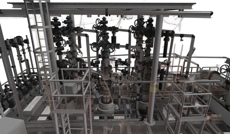
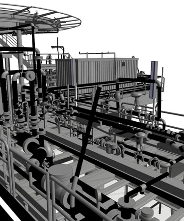
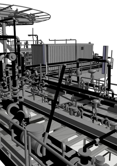
Development of data-rich intelligent 3D models for oil and gas facilities integrating piping systems, structural components, equipment, instrumentation, and operational information into coordinated digital environments. These models support engineering coordination, retrofit planning, clash detection, maintenance workflows, shutdown planning, and long-term asset management.
Process Documentation & Intelligent Diagrams
Development, verification, and updating of P&IDs and PFDs based on actual field conditions, supporting operational accuracy, engineering modifications, maintenance activities, and brownfield project execution.
P&IDs
PFDs
As-built process validation
Integration with intelligent models
Line tracing
Equipment identification
Featured Projects
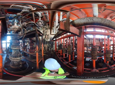
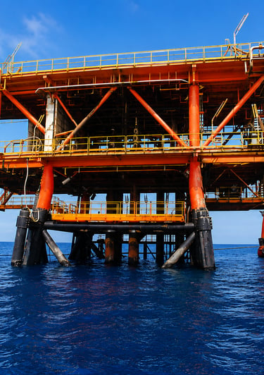
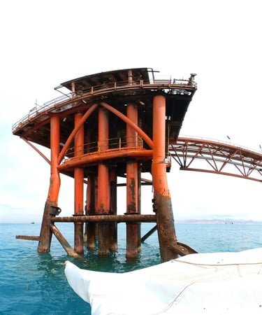
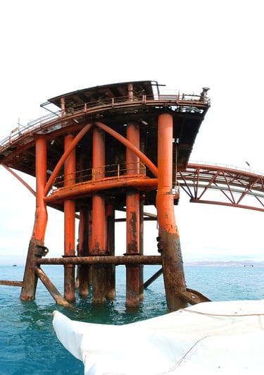
Morgan 1 - Red Sea
➤ Red Sea, Egypt 𝄜 2026
To create an accurate as-built digital representation of an operating oil and gas platform, including geometry, asset information, intelligent modeling, and engineering drawings.
Workflow
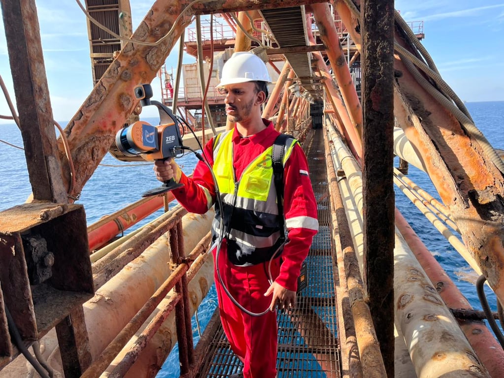
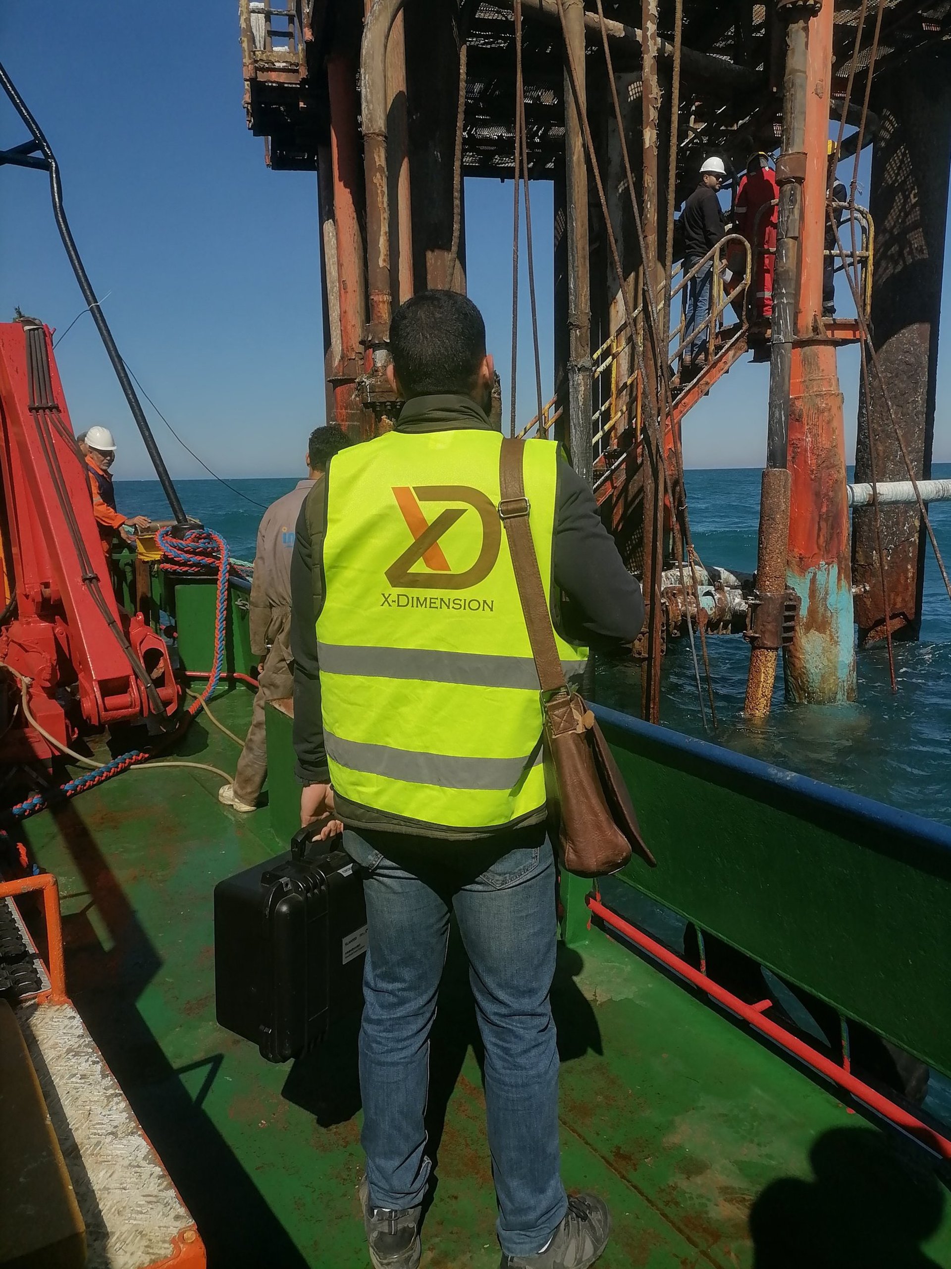
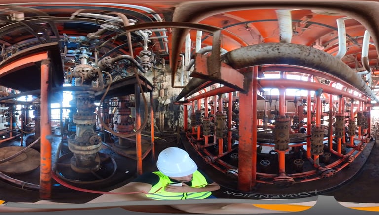
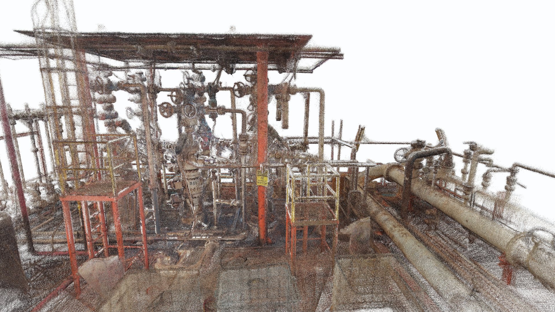
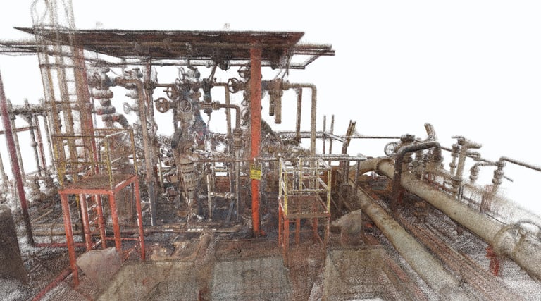
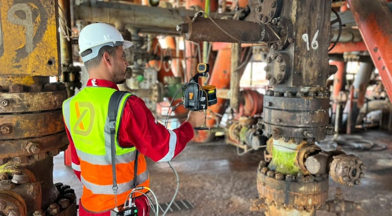
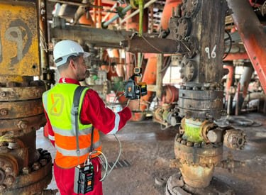
Reality Capture
SLAM-Based Mobile Scanning
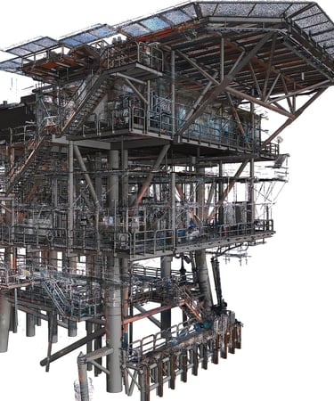
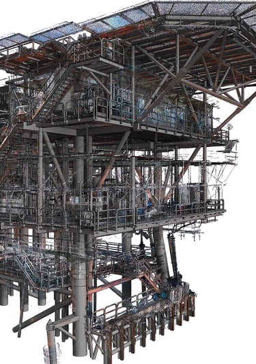
Oil & Gas As-Built Documentation
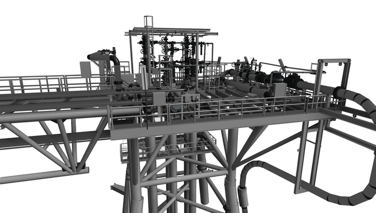
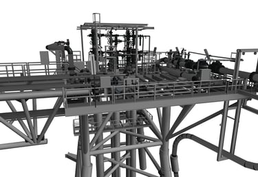
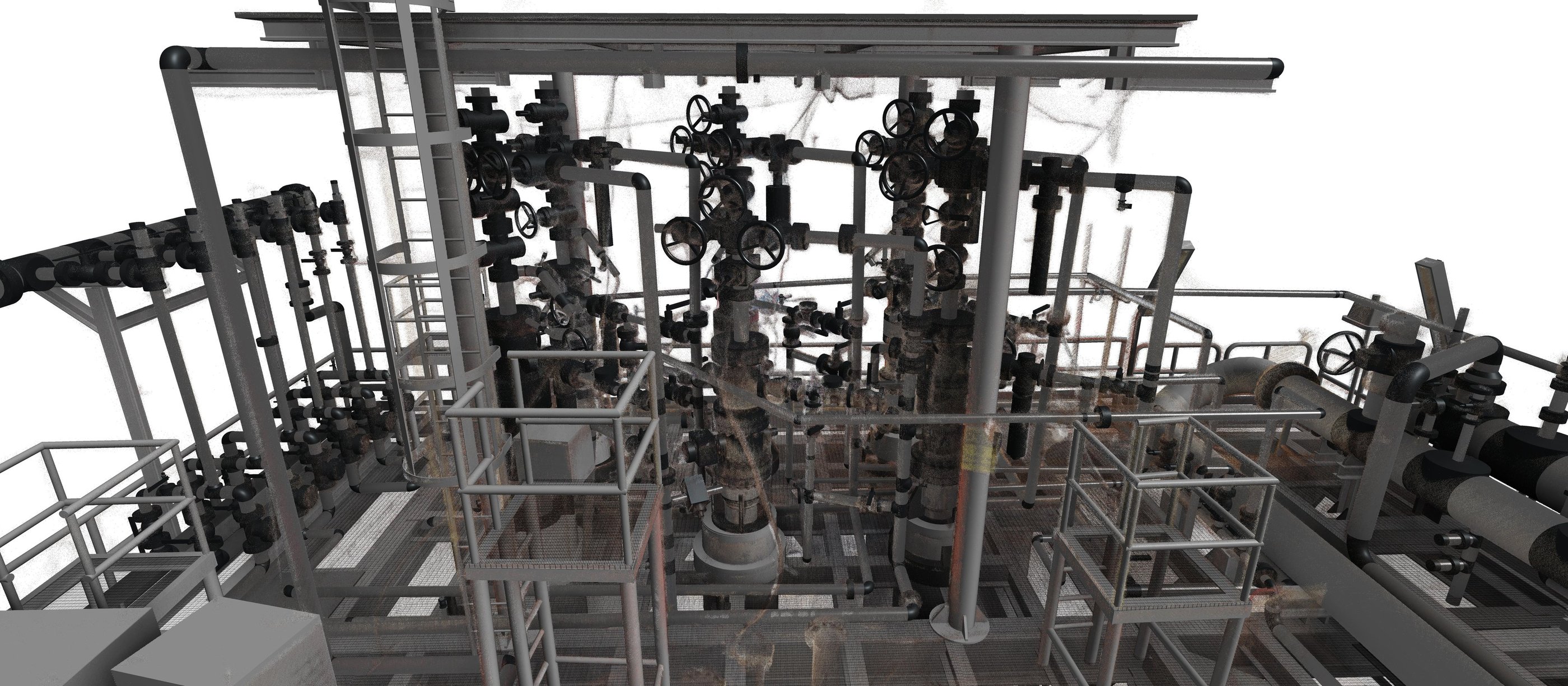
Intelligent 3D Modeling
P&ID-Based Model Development
Digital Deliverables
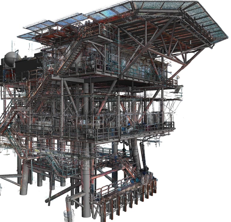
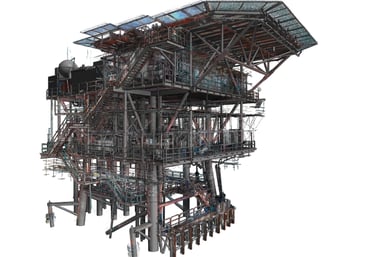
Registered Point Cloud
Intelligent Plant 3D Model
General Arrangement Drawings
Isometric Drawings
Engineering Documentation
Morgan 1 is an active offshore oil and gas platform in the Red Sea. The project required rapid documentation of the existing operational condition and the development of an intelligent model suitable for engineering and operational reference. The timeline was highly compressed, with site capture completed in approximately two to three days. To meet project requirements, X-Dimension combined SLAM-based mobile scanning with available project information and updated P&IDs to produce an intelligent Plant 3D model and related engineering outputs.
Project Purpose
Project Context
Why It Mattered
The project provided a reliable digital foundation for understanding the platform’s actual operating condition, supporting engineering coordination, asset documentation, and future modification or maintenance workflows within a tight delivery window.

MWP4/MWP5 - Red Sea
Ras Ghareb, Egypt - 2024
SP1 - Red Sea
Ras Ghareb, Egypt - 2024
Cl12 - Red Sea
Ras Ghareb, Egypt - 2023
MWP1 - Red Sea
Ras Ghareb, Egypt - 2024

Ready to Start Your Project?
Join our growing list of satisfied clients and experience the X-Dimension difference in reality digitization solutions
Stay connected
Follow us on social media for the latest updates and project showcases.
© 2026 X-Dimension. All rights reserved.
Quick links
Ready to start your project ?
Discuss the project and solution with our team