Lands & Topography Solutions
X-Dimension provides topographic surveying, terrain modeling, mapping, spatial analysis, and digital land documentation workflows using advanced reality capture and geospatial technologies.
Mapping & Reality Capture
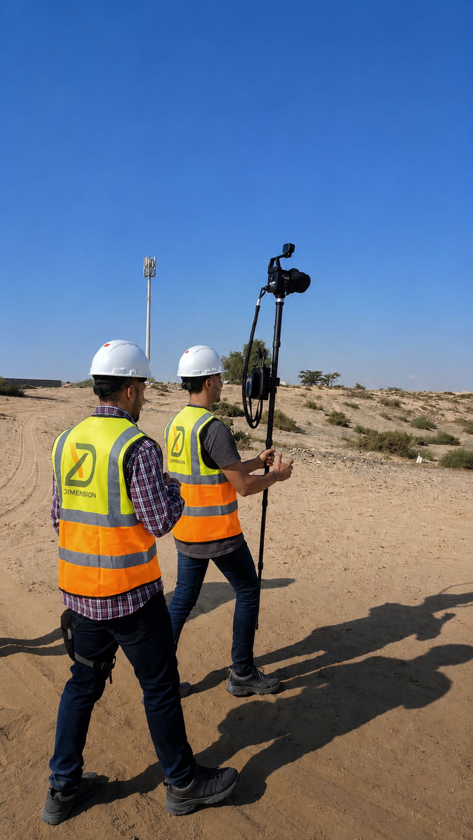
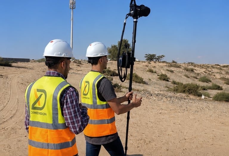
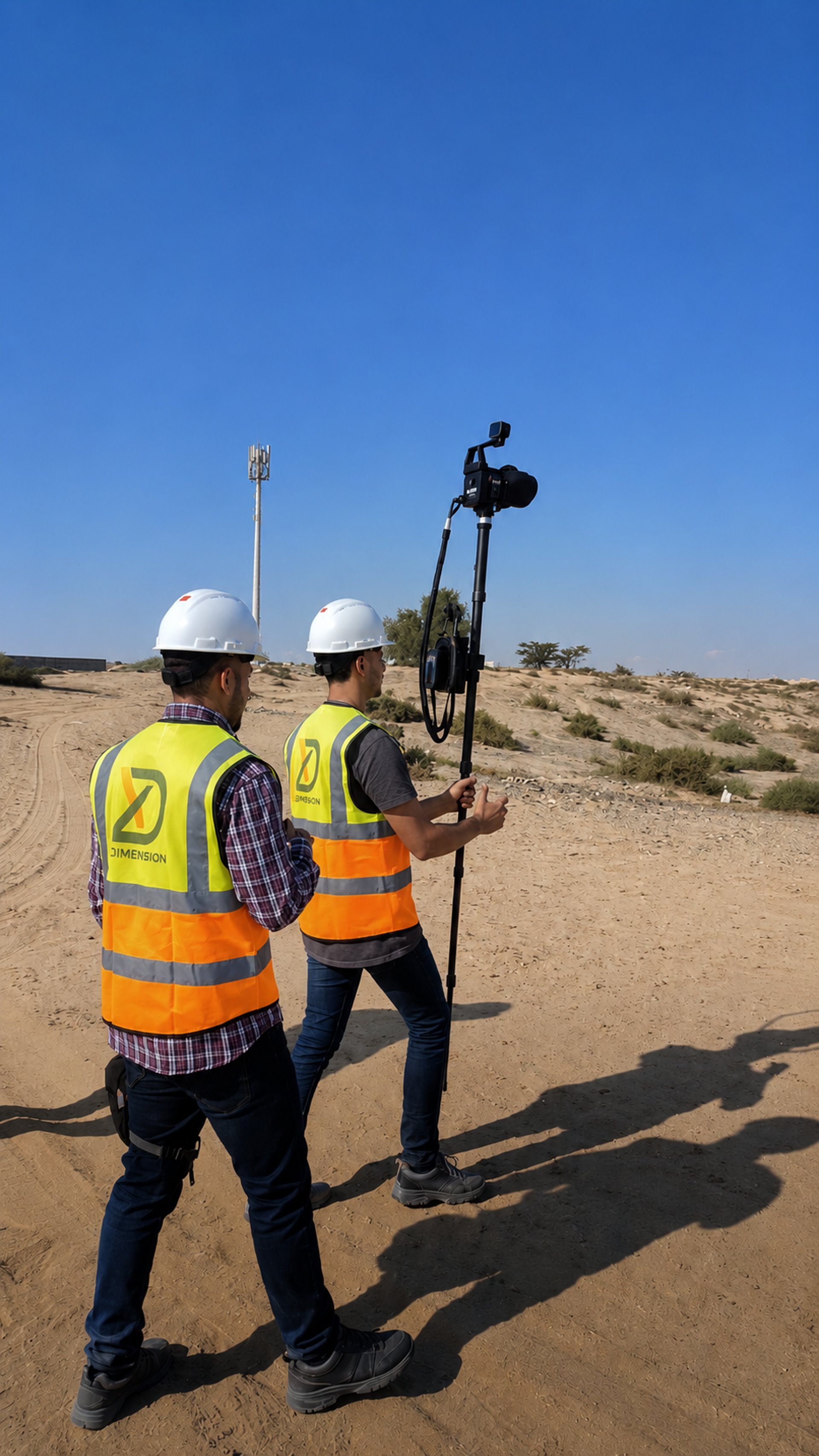
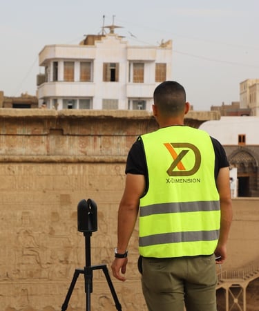
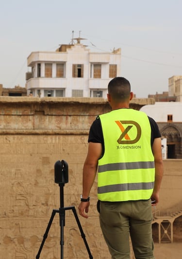
High-accuracy spatial capture of land parcels, terrain conditions, infrastructure corridors, and environments using LiDAR, mobile scanning, photogrammetry, and survey technologies.
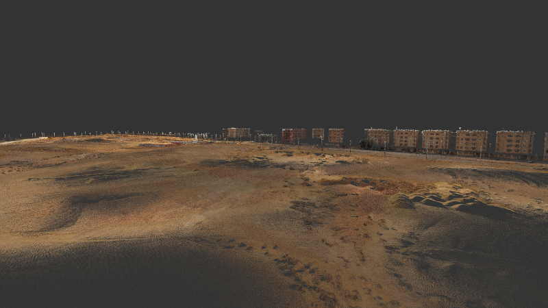
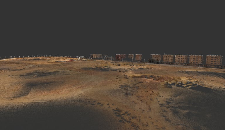
Turning captured land data into clear terrain models, level references, and cut-and-fill analysis for planning, grading, and development decisions.
Land Analysis & Insights


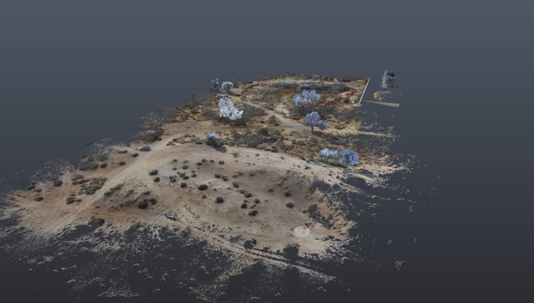
High Fidelity
visual representation for sites

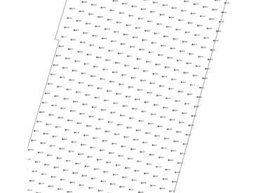
Grid Levelling
at any specific interval


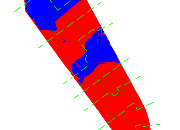
Cut & Fill
Volume calculations
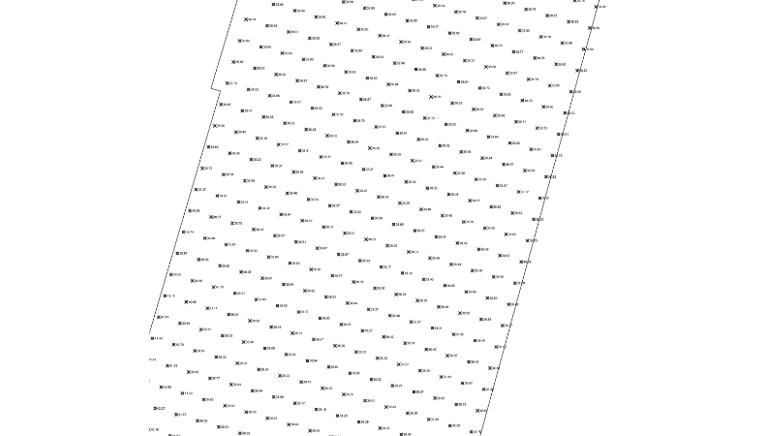

Topographic Surveying & Terrain Modeling
Development of accurate topographic maps and digital terrain models supporting engineering, grading, and development workflows.
Surface modeling
Digital terrain models
Contour generation
Elevation analysis
Featured Projects
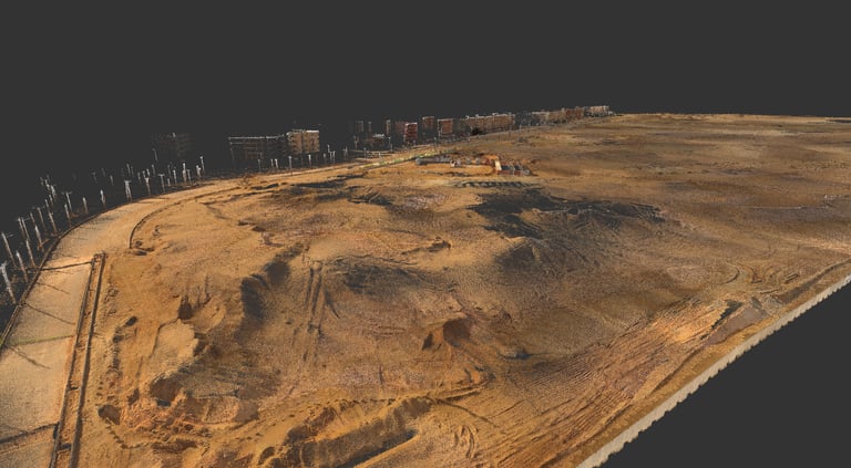
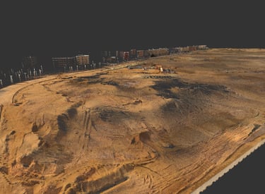
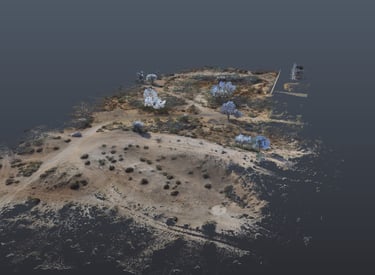
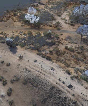
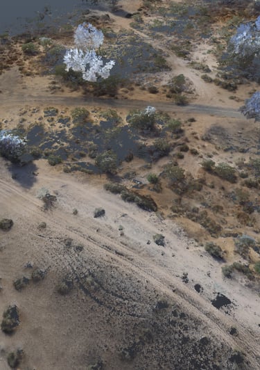
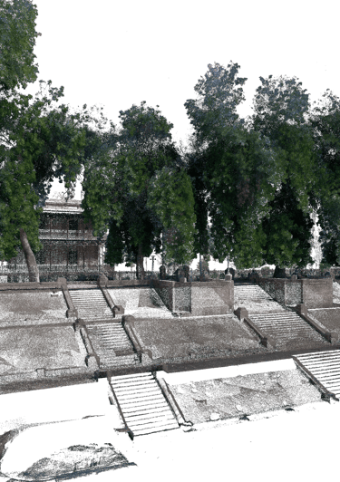
Elaia Compound Land
➤ Cairo, Egypt 𝄜 2025
To document a development land plot and support cut-and-fill optimization for a future compound project.
Workflow
Reality Capture
Topographic Documentation
Digital Terrain Modeling
Cut-and-Fill Analysis
Earthworks Planning Support
Digital Deliverables
Registered Point Cloud
Digital Elevation Model
Drawings
Cut-and-Fill Reports
Volume Calculations
The client needed an accurate representation of the land to plan a complex compound development and study how to optimize cut-and-fill operations. X-Dimension scanned the land, created a digital representation, and developed a visual study showing where cut and fill would be required. The work included volume calculations for different locations to reach the required levels, as well as recommendations on how excavated material could potentially be reused for fill and how the process could be planned efficiently.
Project Purpose
Project Context
Why It Mattered
The project helped the client understand the land condition, optimize earthworks planning, reduce uncertainty in cut-and-fill quantities, and make better use of available site material during development planning.
Al Rahmanneya - Ajman

Derna - Libya
Mataana Royal Marine
Esna Bazarat Street
Cairo, Egypt - 2024
Derna, Libya - 2023
Cairo, Egypt - 2023
Cairo, Egypt - 2023

Ready to Start Your Project?
Join our growing list of satisfied clients and experience the X-Dimension difference in 3D reality digitzation.
Stay connected
Follow us on social media for the latest updates and project showcases.
© 2026 X-Dimension. All rights reserved.
Quick links
Ready to start your project ?
Discuss the project and solution with our team